Jan 7, 2019
Visualization Drones are ideal for visualizing project operations and collecting imagery and video where where access is difficult or dangerous. visualizing exploration operations for stakeholders and shareholders 14 CFR Part 107 licensed remote Pilotsfully...
Oct 6, 2018
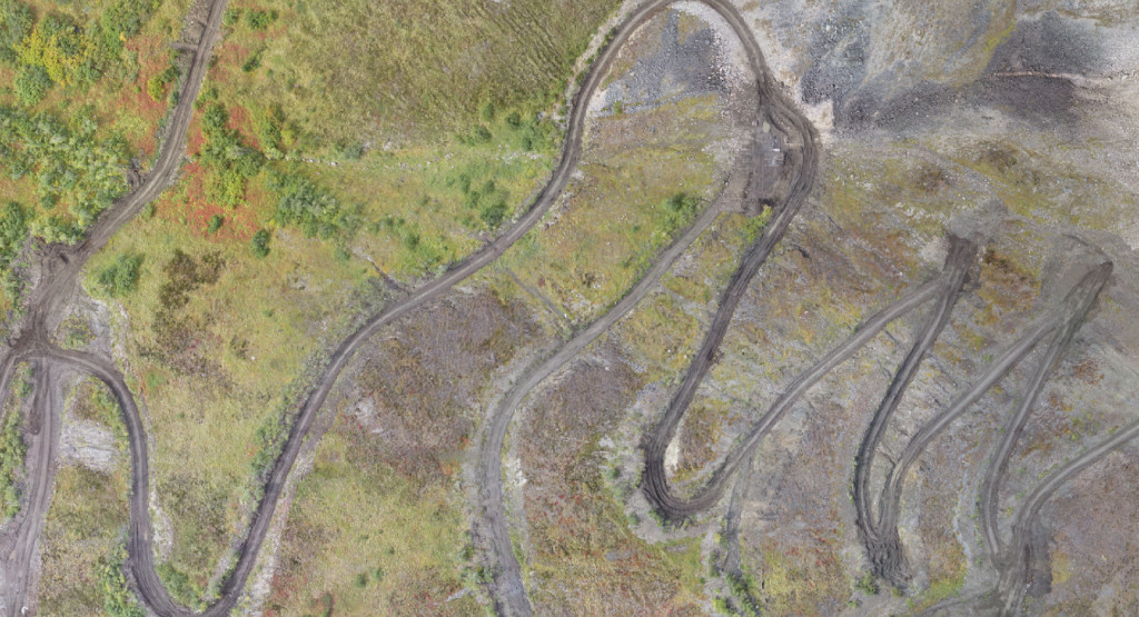
Permitting Orthoimagery can facilitate permitting processes and document compliance, remediation and site reclamation procedures. orthoimagery of a project access road stream crossing detail from orthoimagery info@coraxuas.com(907) 885-4764 | PO Box 1185...
Oct 6, 2018
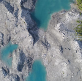
Change Detection Repeat orthoimagery can be used to document worksite impacts, site reclamation, landscape changes and natural processes. repeat imaging for river ice and channelization monitoring monitoring change in dynamic terrain; Mantanuska Glacier toe, Alaska...
Oct 6, 2018
Recreational Sites Orthoimagery is an ideal tool for monitoring and documenting trail conditions and identifying trail work priorities. It can also be used to create high resolution interpretive maps. detail from orthoimagery for trail work planning detail from...
Oct 6, 2018
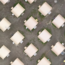
Remote Projects Orthoimagery of your interest area is a powerful tool throughout the lifecycle of the project from access and infrastructure planning to shareholder presentations and resource analysis. digital elevation model of a project area of interest orthoimagery...
Recent Comments